
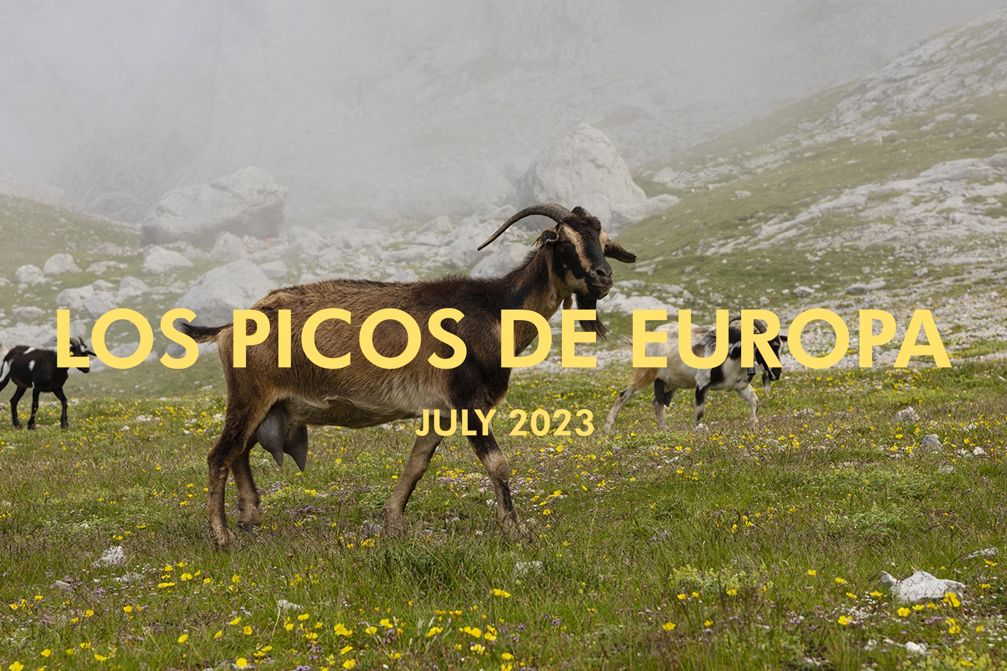
Spent 4 days hiking in Los Picos de Europa in northern Spain covering a little over 30 miles and 15,000 vert in elevation gain.
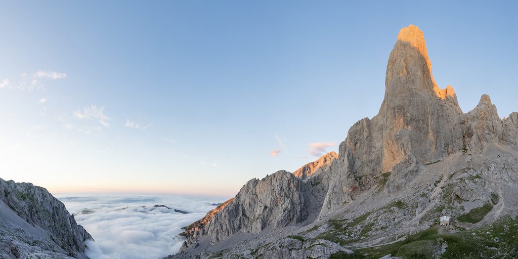
Day 1: Starting out at Hotel Poncebos (900 ft) – Along the famous Rio Cares heading up towards our first small town (Bulnes) which is also accessible by a Funicular. Here you can get your last cup of coffee before leaving villages behind to pasture land for goats (lots of bells) as we gain elevation enroute to Refugio Vega de Uriellu. Last bit of trail we took the route on the right known as Los Traviesas Orientals with sunny weather and rolling clouds (inversion below us) climbing about 6,000 vert making it to camp by 3pm. Spent the afternoon taking some photos and timelapses of the area while watching people climb the sheer face of Picos Urriellu that stands prominent behind Vega de Uriellu.

Day 2: The following morning we left Refugio Vega de Uriellu headed through Jou de Los Boches to the summit of Torre de los Horcados Rojos (8212 ft) enroute you encounter a sign stating “On the route between “Horcados Rojos” and “Jou de los Boches” the cable that was in poor condition has been removed. THERE ARE NO RESTRAINT ELEMENTS, so the passage is only for experienced and physically fit personnel. YOU ENTER A DANGEROUS AREA UNDER YOUR SOLE RESPONSIBILITY.” After making it through that portion slowly we had a nice lunch (My Sister and her partner Jed) at Refugio Cabana Veronica. from there we walked over eroded limestone veins toward Tiro Casares and ending the day at the majestically placed Refugio Collado Jermoso sitting at 6,772 ft. Lots of domesticated goats and the wild Cantabrian chamois (antelope/goat species) on the trail and hanging out on snow patches staying cool. Early July proved to be an excellent time to also enjoy dozens of different wildflowers. It was a hot and sunny day getting the legs a little sun burnt by the time we were done hiking for the day around 4pm.
Day 3: Leaving Collado Jermoso around 8:15am we have a steep decent but are able to make good time making it down 5,000+ ft in elevation by lunch time in the small town of Cain where the lady working the tourist desk had grown up in Arizona? the town follows the Rio Cares which slowly starts to form a very steep canyon with the path starting to be quarried into the cliff along with some water work dam projects. We eventually take a right and ascend up a steep valley to our destination of Vega de Ario standing at 5,331 ft. As we approach the finale 1000 vert the fog/mist becomes dense and visibility diminishes. We start hearing the familiar sound of bells ringing on what we expected to be more goats but this time it was a huge herd of cows roaming the relatively flat plateau that makes up this areas alpine pasture.
Day 4: Our final day hiking legs are a little sore, the cows are mooing and we leave Rufugio Vega de Ario to clear weather and a steep hike back to the Rio Cares. The rest of the hike for the day was following the impressive trail that follows the river and is very steep. Instead of being a mellow walk you are on the edge of a 300+ ft cliff for most of the next 5+ miles back to the car. We find some old building and goats on the trail making it back to the car by 3pm. Seeing the river for most of the day but not being able to access it we found a nice swimming hole in the town of Las Arenas 5 minutes down the road. Saw a snake catch a fish and eat it – we went to a local restaurant had some beer/cider and pintxos to end the trip through Los Picos de Europa.